| Web
and Book design,
Copyright, Kellscraft Studio 1999-2019 (Return to Web Text-ures) |
Click
Here to return to
Vacation Tramps in New England Highlands Content Page Return to the Previous Chapter |
 (HOME)
|
|
III
A SUMMER SAUNTERING FOR the professional hobo New Hampshire is
a most
inhospitable region. For the hiker it is a paradise. There was a time
when
hotel clerks in fashionable mountain resorts looked with haughty
disdain upon
the man whose only baggage was a pack-bag. For a considerable period,
too, even
the farmer-folk looked askance at the man with dusty boots, for the
tramp
terror had been stamped deeply upon the New Hampshire countryside by
repeated
professional hobo outrages. It required drastic special legislation to
rid the
State of this pestilential vagrant, and although that legal prohibition
still
stands in force, it is clear that the people are now able to
discriminate
between tramps and trampers, until farmers and hotel-men alike as
readily open
their doors to-day to the latter, as they vigorously slam them against
the
former. The advent of the automobile drove the
bicycle off
the roads, but to the gentle art of tramping it is destined to be a
stimulation. No car can ever encroach upon the mountain trails, which
will always
remain sacred to the hiker, while out on the open road, the auto is his
friend,
helping him cover monotonous stretches of hot highway, and providing,
through
the increasing patronage of its devotees, new moderate-priced hotels
that cater
to the transient. As for trails, they increase in number
yearly. Old
Abel Crawford and his son, those pioneer hotel-men of the mountains,
recognized
that trails were as essential as frying-pans to their business, for
people went
to the mountains to go into the mountains in those days. There were no
such
counter-attractions as golf and tennis tournaments, or motor trips on
valley
roads. But he who went into the mountains a hundred years ago (and it
is
considerably more than a century since the first hotel was built where
now
stands Fabyans)1 had to pick his own way and rough it. In
recent
years the mountaineering clubs have opened mile after mile of trail,
even to
the remotest ravines and summits, and latterly the hotels, noticing
that there
are still those who go to the mountains for their own sake, have
followed the
example of the Crawford family and have built pretty paths for the
ramblers
and good trails for the walkers who may chance to be guests beneath
their
roofs. There are times when two is a company and
three a
crowd, but that does not necessarily apply to a jaunt of this nature.
A third
man has his good points, and for the sake of even numbers and general
good-fellowship a fourth also may be considered. But Thoreau's precept
as to
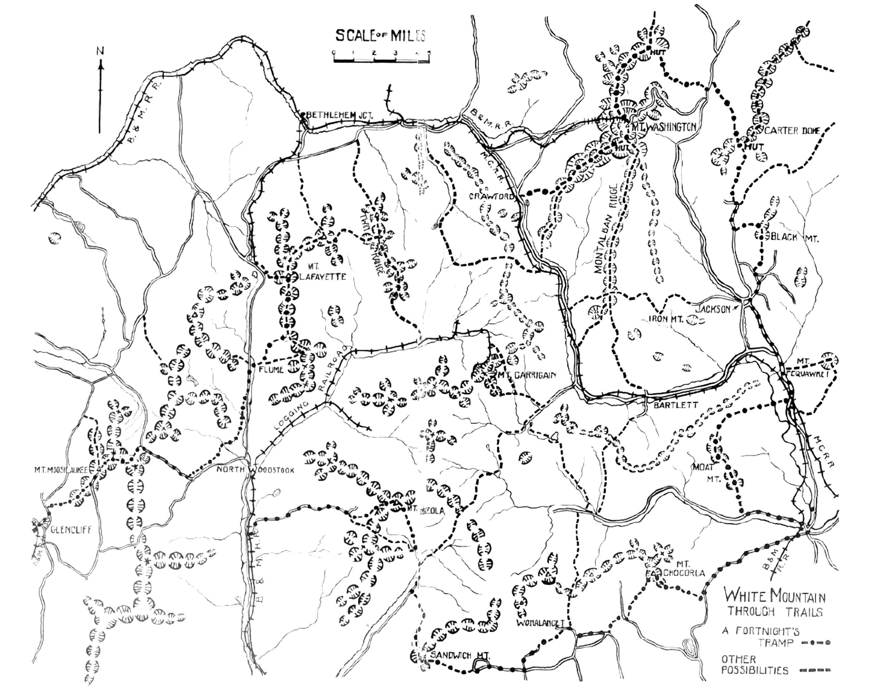
companions may well be kept in mind. The charting of the course in advance is
important,
and one of the most enjoyable features of the trip. Let the controlling
factors
be that there shall be a minimum amount of railroading and motoring
involved,
that the days' marches shall not be fatiguingly long, that a good bed
shall be
available every night, and that, without recourse to high-priced
caravansaries,
also that the cream of the scenery be included in measures of standard
size.
This requires careful study and consideration of the best maps and
guide-books
of the region to be covered, and the timetables of the railroads (for
the
White Mountains this means the running schedules of the White Mountain
and
Portland Divisions of the Boston & Maine, of the White Mountain
Division of
the Maine Central, and of the Grand Trunk), and the summer resort lists
issued
by those same roads as well, these latter to furnish hints as to
stopping-places along the way. Four of us, who knew that we could travel
together on
the Thoreau principle for two weeks, thus planned out what we
considered the de
luxe tramp of the White Mountains. Our time limit was the traditional
two
weeks' vacation. Our daily mileage was to be governed by what we could
do in
comfort. There was to be no attempt at big stunts or record times. The
impetuosity of youth had long since ceased to dwell with any of the
four. We
knew that blistered feet had no place in the good time we planned. One
mile an
hour uphill was to be our gait, with three times that at a steady swing
on level
going. Due allowance was made for occasional hold-ups on rainy days,
and rights
were reserved to change our course at will should the inclination
prompt it.
It all worked out to a charm. In two weeks, in the midst of an
abnormally heavy
rainfall, but one day was lost from that cause. Only twice were we
caught and
thoroughly soaked (even waterproofs are not invulnerable at all times),
and on
both of these occasions this was due chiefly to our own carelessness.
And only
once did the weather force a radical change in the day's programme. The itinerary of the trip, in the main
devoid of
flourishes as to its scenic charms, may be sketched in briefest form
for the
benefit of him who would follow on. Glencliff, at the height of land between
the
Pemigewasset and Connecticut waters, was our jumping-off place. Three
trains a
day from Boston stop there, and quarters for the night are available in
the
little village by inquiring of the station-master. Arrivals by the two
earlier
trains will have no cause to tarry here except on account of weather,
and the
Dartmouth (College) Outing Club's trail to Moosilaukee summit is easily
found
by inquiry at the station. It is a beautiful trail, well watered,
steady, and
easy of grade, and Moosilaukee is well worth a climb, for the view it
commands
is extensive. For those who ascend in the afternoon the little summit
hotel
offers shelter and substantial fare, but if the ascent is made in the
morning,
four hours and a half being amply sufficient for the slowest walker to
cover
the five miles, the descent into Kinsman Notch can be made during any
three
hours before sunset. We felt that the full day that we devoted to the
mountain
was anything but wasted, the morning spent in a leisurely ascent, the
afternoon
in roaming about the moor-like summit tableland, followed by a
refreshingly
restful night in that clear upper air. 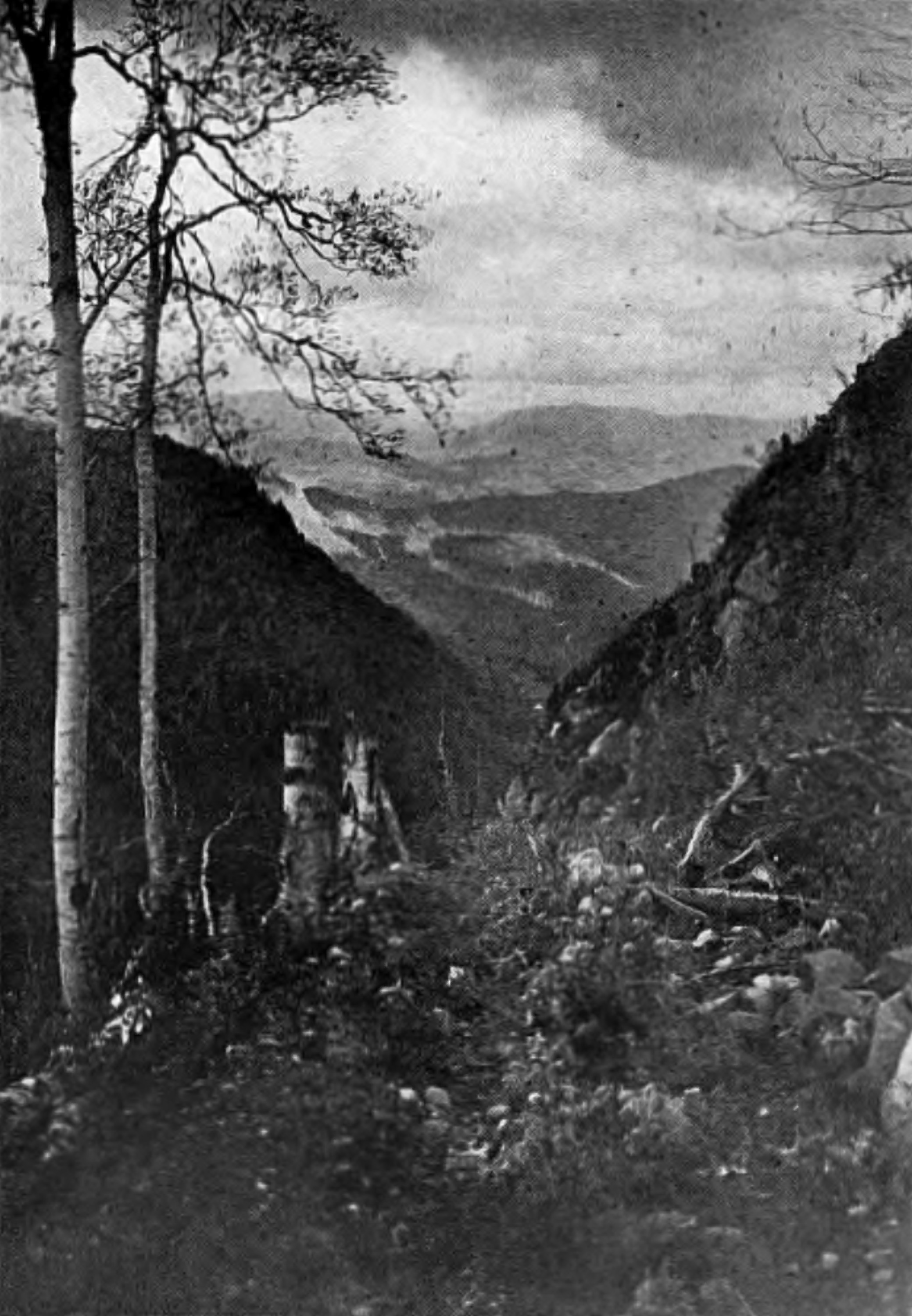 The trail down the eastern slopes of Moosilaukee Within a scant half-mile of where the
trail down the
eastern slopes of Moosilaukee emerges upon the State highway in Kinsman
Notch,
we found the tidy log cabin of the Society for the Protection of New
Hampshire
Forests, where the custodian made us welcome with food of a filling
sort, and
bunks fragrant with newly pulled balsam tips. Kinsman Notch, until the
building of the State road in 1915, was an almost unknown region. The
Beaver
Meadows and the underground passages of Lost River, now protected
within the
three-hundred-acre reservation of the Forestry Society, are among the
notable
attractions of the mountains. It is singular that this gorge, now
deservedly
famous as the third great natural wonder of the Franconia section of
the
mountains, should have remained undiscovered until 1895, within seven
miles of
a long-established summer resort. The profile of the Old Man of the
Mountain
on the Cannon Mountain cliffs, overlooking the Franconia Notch, has
been known
far and wide for many years. So, too, the Flume, at the southern end of
the
same great notch, has been one of the notable spectacles of the
mountains ever
since mountain touring began. And yet the Lost River lay hidden in the
forest
until a local guide stumbled upon it by chance only twenty-odd years
ago. In
the estimation of one of its earliest explorers, the late Frank O.
Carpenter,
of Boston, it "far surpasses the Flume in its surprises, its massive
rock
architecture," and is "unique in its dark, gloomy caverns."
Though but three or four hundred feet wide, this cleft in the mountain
extends
from a third to half a mile, the stream corkscrewing its way through
the dark
passages from forty to seventy-five feet below the crest of the canyon
walls.
One of the first to make the passage of these Stygian caves found that
three
hours of continuous exertion had been required for the trip. To-day,
thanks to
the bridges and ladders placed by the Forestry Society, the
difficulties and
dangers have vanished, and a single hour suffices for the easy passage
through.
Just what caused this tumbled mass of
rock, which
now, as a spectacle, attracts thousands of sight-seers every year, has
somewhat
perplexed those geologists who have seen it. In the opinion of Robert
W.
Sayles, of the Department of Geology at Harvard University, who has
studied the
caverns, this river became lost perhaps twenty-five thousand years
ago, when,
toward the close of the glacial period, an earthquake shook the cliffs
above
and tumbled down the great blocks that now fill the gorge, burying the
stream
from sight. The great pot-holes in the stream-bed, which are among the
curiosities of the present day, he has pronounced to be the largest
known
anywhere in this country, and he thinks that they must have been
caused,
perhaps just prior to the earthquake, by a torrent of water that poured
through
the notch from the melting glacier that filled the great valley to the
westward. Of this he feels certain, although admitting that the
earthquake
theory requires further study for complete substantiation. The next attraction along the route is the
walk
across the ridge of the Franconia Range, but it is a half-day's tramp
thither
through the woods from Kinsman Notch to the hotel at the Flume. The
first three
miles is on the highway toward North Woodstock, which brings the
tramper to the
site of a burned logging mill. Here the bed of the old lumber railroad
leads
sharply to the left, and winds around through the woods six miles to
its
junction with the Franconia Notch highway, two miles below the Flume,
all of
which may be covered in a long forenoon. A lazier way would be to
continue on
the highway from the old mill for four miles to North Woodstock
village, with
a glimpse of the Agassiz Basins on the way, and catch the motor stage
up the
Franconia Notch on the morning or afternoon run. A pleasant afternoon
at Flume
need not drag, for the trail behind the hotel leads in an hour to the
top of
little Pemigewasset Mountain, a glorious viewpoint for the notch
ranges, and
back toward Moosilaukee. Or if upgrade walking is not attractive,
there is
the stroll to the Pool, and up the road to the great pot-hole known as
the
Basin. 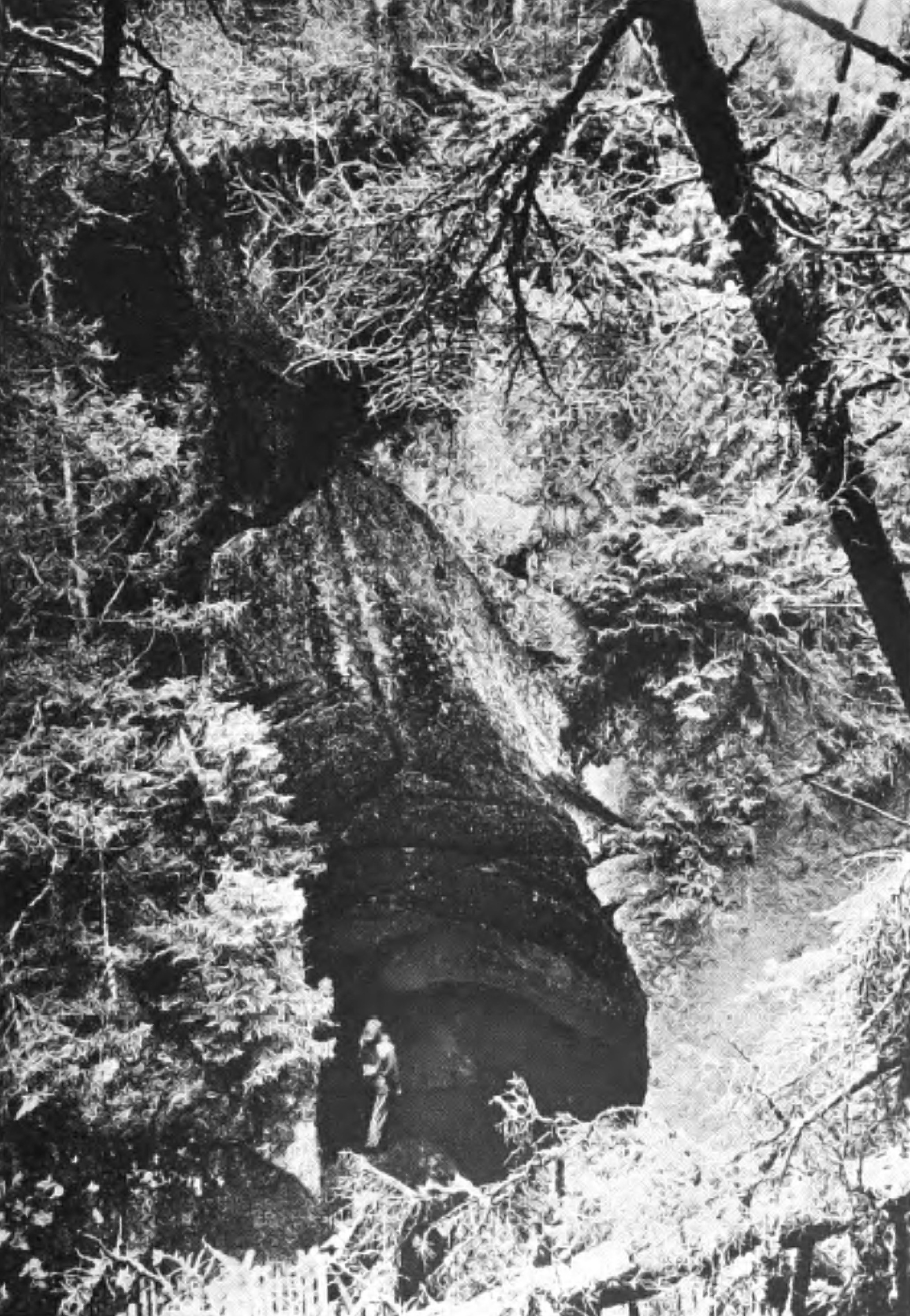 One of the great pot-holes in Lost River’s Gorge It being a piping-hot morning when we
turned out at
Bethlehem Junction and cast our eyes toward Mount Washington, we
readily
decided to spare ourselves the unnecessary toil of clambering up the
Mount
Pleasant path, and bought our railroad tickets through to the Summit
Station
instead of to the Base. Doubtless many would prefer to railroad around
to
Crawfords, and ascend by the historic Bridle-Path to the Appalachian
Mountain
Club's hut at the Lakes of the Clouds, a glorious stroll of six miles,
more
than half of it above the timber with the world unrolled beneath.
Mountaineer
beds and fare are at the service of all comers at the hut, or real beds
may be
found at the hotel on the summit of Mount Washington, an hour's climb
beyond. A more alpine approach to the Great Range
would be to
continue on the train to Willey House Station, and clamber up the
cliffs of
Mount Webster by one of the most interesting trails in all the
mountain
region. But it is long and it is steep, and from Webster's summit to
the Lakes
of the Clouds hut it is eight stony miles. Only the stoutest of legs
should
attempt it, and in nothing short of the finest of weather. 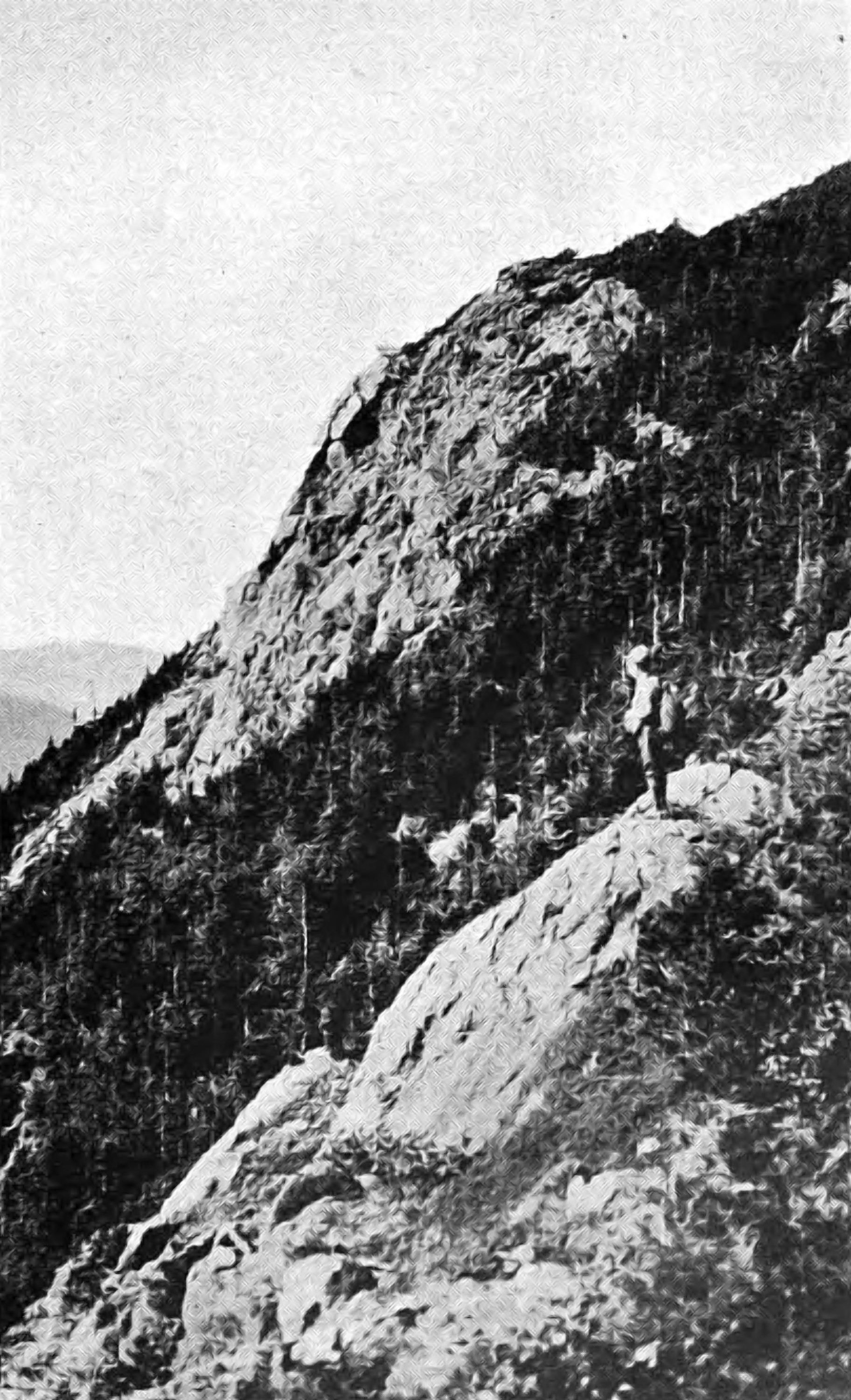 The cliffs of Mount Webster To cross the Franconia or the Presidential
Ranges in
a simple summer cloud may not be prudent for the inexperienced, as the
trails
are dim amid the rocks, and the cairns are readily missed. To attempt
to force
their passage in a cold and freezing rain, a condition that is
sometimes
experienced at those altitudes even in summer, is positively perilous,
and
lives have already been sacrificed to such foolhardiness. From the Madison huts to the Glen the map
will show a
choice of mutes, or if it is voted that this should be the climax the
railroad
is easily reached in less than four miles of downgrade on the opposite
hand. A
prime favorite Glenward is through the virgin forest of Madison Ravine
by
Parapet Brook and the Gulf. With us a leisurely week had already been
consumed, and the descent was made for a Sunday amid the semi-urban
joys of
Gorham, whither our spare clothes had preceded us by parcel post. To complete the circuit of the mountains
through the
east and south the obvious route from Gorham leads over the crest of
the
Carter-Moriah Range. From the outskirts of Gorham village the trail
leads
across the Huggermugger Bridge and up the slope of Mount Surprise, with
its
inspiring view of Mount Madison and Mount Washington, and continues on
over the
summit of Mount Moriah and down into the saddle of Imp Mountain, an
easy day's
ramble, but one that involves the necessity of camping at this point in
the
Appalachian Club's shelter. Another similar day, still following the
ridge
trail south over the Carters to the Dome, brings one at night into the
remote
fastnesses of the Carter Notch with its hospitable hut. Till comes that
happy
day, and come it will, when a hut is opened midway the Carter Range,
the easier
road to the notch along Nineteen-Mile Brook will doubtless be the
choice of
most. Crawford Notch, Franconia Notch, and
Pinkham Notch
are all well-known White Mountain localities, but, except to a
comparatively
small number, Carter Notch is scarcely more than a name. To the
tramping
fraternity it is known as a wild gorge between the Carter-Moriah and
Wildcat
Ranges, but as neither railroad nor wagon-road passes that way, no
others have
seen the beauties of its precipitous walls, or felt the charm of its
sparkling
twin tarns. To those whose strength of wind and limb have carried them
into this
wild spot it has a fascination that draws them again and again, not
only in
summer, but in the dead of winter as well. Now that this notch has
come into
possession of Uncle Sam as a part of the White Mountain National
Forest, it is
destined to be better known, for as time goes on the Government will
open up
such places with better trails, trails adapted to saddle animals as
well as to
pedestrians. For one descending Mount Madison through the Gulf, it is
an easy
afternoon's stroll from the Glen into the notch, where a day may be
most
enjoyably spent in exploring its caverns, in whipping the lakelets to
lure
their speckled trout, or in climbing to the summit of the overhanging
Dome for
its wide and much-repaying view. From Carter Notch a pleasant valley trail
leads to
the south five miles to the upper end of the Jackson valley, there
connecting
with a path to the summit of Black Mountain with its observatory,
which
commands one of the best views of the Great Range. If the trail along
the ridge
of Black is followed south from the tower toward Jackson village, a
most
interesting day can be completed within a total of some ten far from
difficult
miles. A night in one of the numerous hotels in
Jackson and
again the future road must be mapped out. It is a safe assumption that
the
first step thence will be toward Mount Pequawket's summit, most readily
reached
from the Jackson side by the Pitman Trail, some four miles down the
Thorn
Mountain road in Lower Bartlett. Descending from Pequawket to Intervale
for the
night the next most attractive possibility is to cross the interval and
the
Saco River to Diana's Baths for the ascent of North Moat Mountain,
spending
the day in the ramble along the ridge toward the south. If a telephone
message
has been sent ahead in the morning before setting out, for a helpful
automobile
to meet the rovers as they emerge on the Albany Interval road in the
late afternoon,
the day will end with a comfortable night at the hotel at the foot of
the Weetamoo
Trail to Mount Chocorua, the starting-point for yet another day. Chocorua sentinels the eastern end of the
southernmost rampart of the mountains, the Sandwich Range. No White
Mountain
trip could be complete for us that omitted the climb up Chocorua's
rocky crest,
with a night at the little house that snuggled for twenty-five years
beneath
the cone. Wrecked by the great gale of September, 1915, it was restored
in part
the following year only to be again swept away in that winter's storms.
Homely
it was in the Yankee sense, but in the hearty greetings of its veteran
landlord, David Knowles, and in the unpretending but generous quality
of its
entertainment, there was true homeliness. The pleasant memories of that
little
house among the rocks, that remain with thousands who have been its
guests,
afford a firm foundation for its successor. Now that the only refuge that the
mountain affords
is the chilly cavern beneath the great Cow Rock, where Frank Bolles
once passed
a lonely vigil with the stars, few will know the glories of a night on
that
windy watch-tower, but will seek their shelter in the valley to the
south. A
long summer's day will be ample to cross the mountain, descending
through the
fine old forest along the Brook Trail, or by the Bee-Line route, with
its
recurring backward views of the cone above, to Paugus Mill and
Wonalancet
village. With two more full days Sandwich Mountain will be crossed, by
way of
Whiteface Interval and Jose's Bridge, into Waterville,- and Mount
Osceola
ascended for the final stretch down its western side to the railroad at
Woodstock, almost at the foot of Moosilaukee once more. 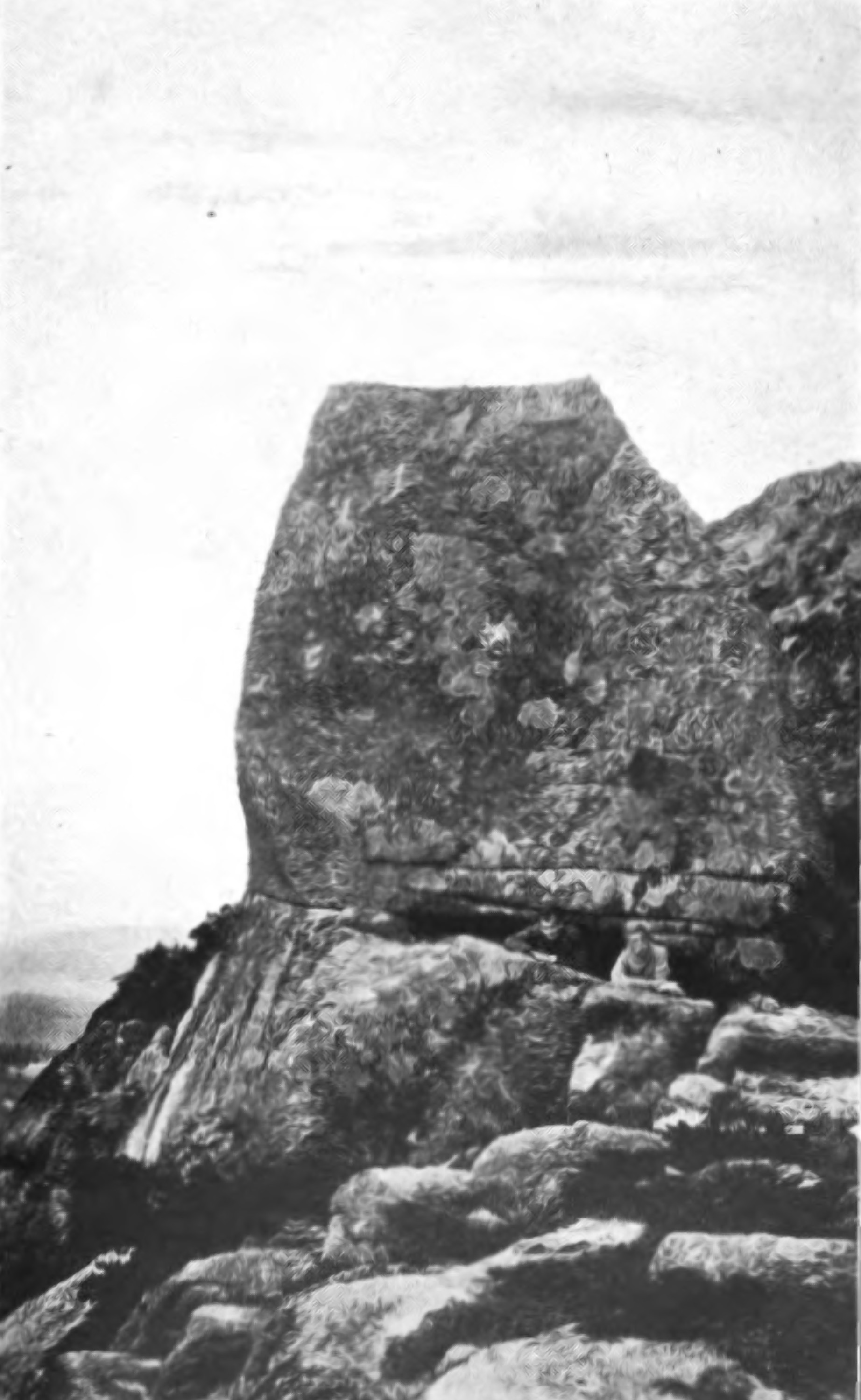 Chocorua’s Great Cow Rock
* The mileage and elapsed time are
cumulative for
each day, distance and time being figured from point last named in
previous
line. The times here given are sufficient for leisurely walking. MAPS: White Mountain National Forest, two
miles to
the inch, published by the U.S. Forest Service. Mailed on application
to Forest
Supervisor, Gorham, N.H. Eleven sectional trail maps of the White
Mountains,
drawn by Louis F. Cutter, and published by the Appalachian Mountain
Club,
Boston, Mass. 1
Eleazer Rosebrook, grandfather of Ethan Allen Crawford, opened his
house to
travelers in 1803. |
||||||||||||||||||||||||||||||||||||||||||||||||||||||||||||||||||||||||||||||||||||||||||||||||||||||||||||||||||||||||||||||||||||||||||||||||||||||||||||||||||||||||||||||||||||||||||||||||||||||||||||||||||||||||||||||||||||||||||||||||||||
